
You arrive at a new campground, check in at the office, and get handed a piece of paper. It’s got lines, numbers, arrows, and boxes.
Yep—it’s the campground map.
But what does it all mean?
Let’s break it down so you can read a campground map like a pro, find the perfect spot, and avoid surprises before you even park.
🧭 Why Campground Maps Matter
A campground map helps you:
-
Find your campsite number
-
See where the entrance, exits, and roads are
-
Locate things like restrooms, trash bins, and dump stations
-
Check if your site is pull-thru or back-in
-
Choose a spot with the best shade, space, or view
Understanding the map can make check-in smoother and your whole stay more relaxing.
🔢 What the Numbers Mean
Most maps show site numbers:
-
These match the number given to you at check-in
-
Look for your number on the map to know where to go
-
Some sites have letters too (like A12 or B3)—be sure to match the letter and number!
Tip: If the numbers are out of order, check for arrows showing the one-way traffic flow.
🚐 Site Shapes and Directions
Look closely at how the site is drawn:
-
A long rectangle or arc may mean it’s a pull-thru site
-
A short box off a road is usually a back-in site
-
Some maps use arrows to show entry direction
Knowing this helps you line up your RV properly without needing to turn around.
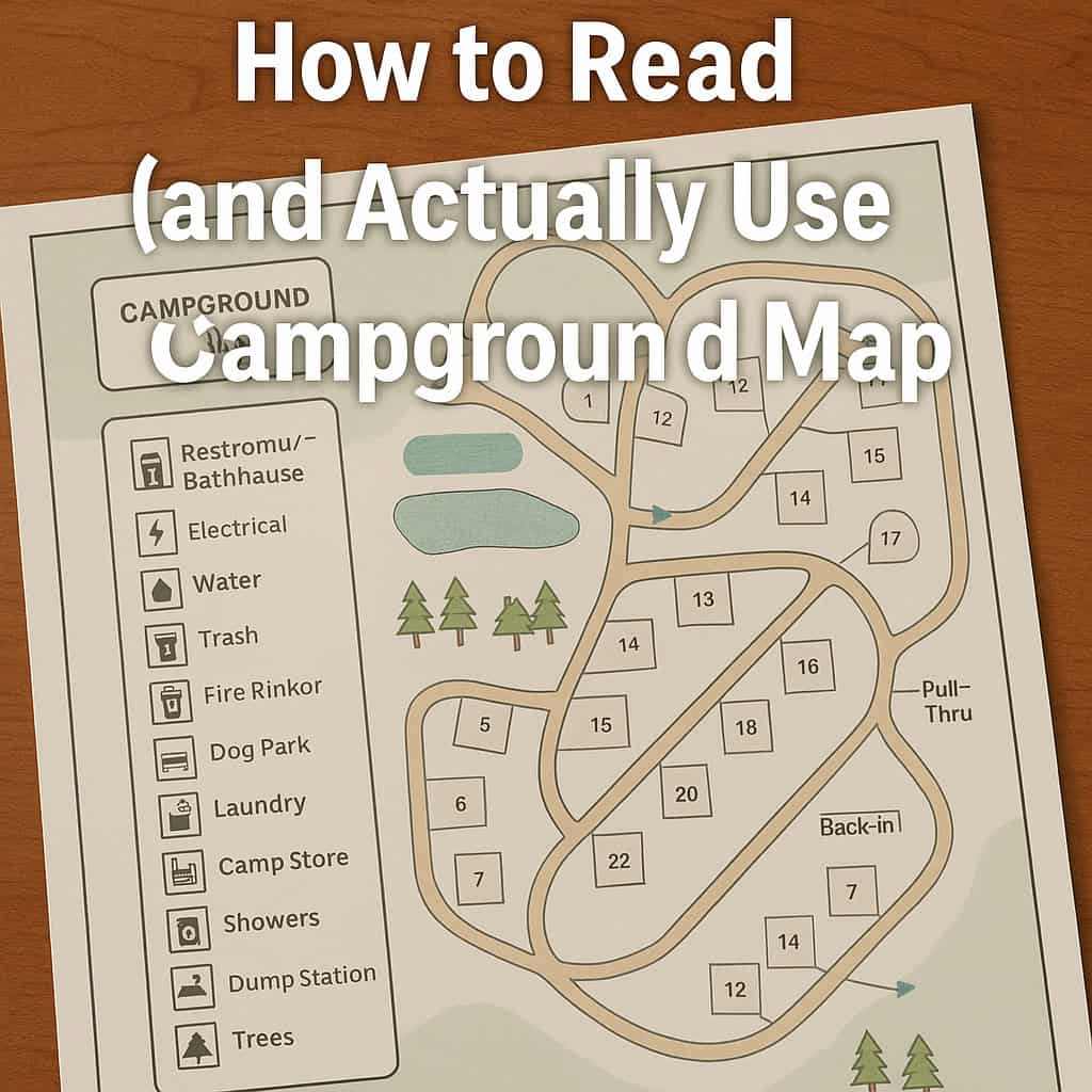
🧼 Common Symbols on Campground Maps
Every campground is different, but here are common symbols to look for:
| Symbol | Meaning |
|---|---|
| 🚻 or 🛁 | Restrooms / Bathhouse |
| 🔌 | Electrical hookups |
| 💧 | Water hookups |
| 🗑️ | Trash or recycling |
| 🔥 | Fire ring or firewood area |
| 🐾 | Dog park or pet area |
| 🅿️ | Parking area |
| 🧺 | Laundry |
| 🛒 | Camp store |
| 🚿 | Showers |
| 🪠 | Dump station |
| 🌲 | Trees / shaded areas |
There’s usually a legend (key) on the map that explains what each symbol means.
🏕️ Choosing a Good Site (If You Get to Pick)
Use the map to help find:
-
Shaded sites near trees
-
Sites away from busy roads if you want quiet
-
Spots near the bathhouse if you don’t have full hookups
-
Pull-thru sites if you’re in a big rig
-
Sites near the playground if you’re camping with kids
But also check:
-
Where dump stations are (they can be noisy)
-
How close neighbors are
-
If the site is near bright lights or open spaces
🧠 Bonus Tips for Using the Map
-
Ask the office staff if the map looks confusing—they’ll point you in the right direction.
-
Take a photo of the map on your phone in case the paper version gets lost or wet.
-
If you arrive after dark, use the map with a flashlight or phone light to find your site.
-
Some campgrounds also have QR codes that link to a digital version of the map!
Final Thoughts
Campground maps may look a little confusing at first—but once you know what the symbols mean and how to follow the layout, they’re super helpful.
Use them to pick your perfect site, find your way around, and get the most out of every stay.
Because when you understand the map, your whole trip goes smoother.